skip to main |
skip to sidebar
New study reveals the possibility of hurricanes ‘unlike anything you’ve seen in history’

September 2015 – CLIMATE – Last
week, the nation focused its attention on the 10-year anniversary of
Hurricane Katrina, the most destructive hurricane in U.S. history. As
bad as the storm was, though, it wasn’t the worst storm that could have
possibly hit New Orleans. That’s true of many, many other places, too.
And now, in a new study in Nature Climate Change, Princeton’s Ning Lin
and MIT’s Kerry Emanuel demonstrate that when it comes to three global
cities in particular — Tampa, Fla., Cairns, Australia, and Dubai, United
Arab Emirates — there could come a storm that is much worse than
anything in recent memory (or in any memory).
Granted, these theoretical storms are
also highly unlikely to occur — in some cases, they are 1-in-10,000-year
events, or even rarer. The researchers refer to these possible storms
as “gray swans,” riffing on the concept of a “black swan” event, an
unpredictable catastrophe, or highly impactful event. A “gray swan,” by
contrast, can indeed be predicted, even if it is extremely rare. The
purpose of the study is “to raise awareness of what a very low
probability, very high impact hurricane event might look like,” said
Emanuel. The gray swan storms were generated by a computer model that
“coupled” together, in the researchers’ parlance, a very high-resolution
hurricane model with a global climate model. That allowed the
researchers to populate the simulated world with oodles of different
storms.
“When you do hundreds and hundreds of
thousands of events, you’re going to see hurricanes that are unlike
anything you’ve seen in history,” said Emanuel, a key theoretician
behind the equations determining the “maximum potential intensity” of a
hurricane in a given climate. Indeed, he has published in the past that a
theoretical “hypercane” with winds approaching 500 miles per hour is
possible in scenarios where an asteroid hits the Earth and radically
heats up ocean waters, far beyond their normal temperature.
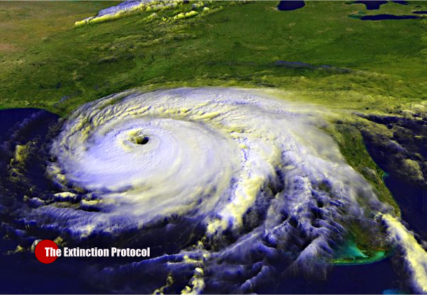
So what did the researchers see? Let’s
take Tampa Bay, first. It hasn’t been hit by a major hurricane since
1921 — but that storm drove a 3- to 3.5-meter (10- to 11-foot) storm
surge and caused dramatic damage. Earlier, in 1848, another storm
produced a 4.6-meter surge (about 15 feet). Why is Tampa Bay so
vulnerable? Check out any good map that shows the water depth (the
bathymetry) around the Florida peninsula. It’s deep off the east coast.
But there’s an extraordinarily broad continental shelf off the west
coast. And although the city of Tampa, proper, sits at the head of Tampa
Bay, relatively far from the mouth and well removed from the barrier
islands that get battered by the waves from the Gulf of Mexico, that’s a
more vulnerable spot than you’d think.
“One can get much larger surges where
the offshore waters are shallow, as is true along the west, but not the
east coast of Florida. Also, surges can amplify by being funneled into
bays,” Emanuel said Monday in an e-mail. The new method allows the
researchers to show that a worse storm than these historical examples is
possible, especially with sea level rise and global warming. They
simulated 2,100 possible Tampa Bay hurricanes in the current climate,
and then 3,100 each for three time periods (2006 through 2036, 2037
through 2067, and 2068 through 2098) in an unchecked global warming
scenario.
In the current climate, the study found
that a 5.9-meter (19-foot) storm surge is possible, in a strong
Category 3 hurricane following a similar track to Tampa’s classic 1921
and 1848 storms. Moreover, in a late 21st century climate with global
warming run amok, the worst-case scenario generated by the model
included a very different storm track, moving north along Florida’s Gulf
Coast and then swerving inland at Tampa, that generated an 11.1-meter
(nearly 37-foot) surge. –Washington Post


0 comments:
Post a Comment